Our website is made possible by displaying online advertisements to our visitors.
Please consider supporting us by disabling your ad blocker.
Reda (river)
| Reda | |
|---|---|
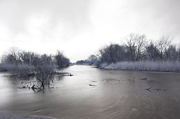
 Reda River and the surrounding landscape | |
 | |
| Location | |
| Country | Poland |
| Physical characteristics | |
| Mouth | |
• location | Bay of Puck |
• coordinates | 54°38′28″N 18°28′25″E / 54.6411°N 18.4736°E |
| Length | 45 km (28 mi) |
| Basin size | 485 km2 (187 sq mi) |
The Reda is a river in northern Poland in the Pomeranian Voivodship. It empties into the Bay of Puck, a part of Gdańsk Bay.
The Reda is 45 km long, and drains about 485 square kilometers. It flows within the geographical region of Pobrzeże Kaszubskie; bordering Puszcza Darżlubska (English: Darżlubie Forest, or Darżlubska Wilderness) to the north, and the Tricity Landscape Park (Trójmiejski Park Krajobrazowy) to the south.
Previous Page Next Page


