Our website is made possible by displaying online advertisements to our visitors.
Please consider supporting us by disabling your ad blocker.
Rio Arriba County, New Mexico
Rio Arriba County | |
|---|---|
 Rio Arriba County Courthouse, Isaac Rapp, architect, 1916-17 | |
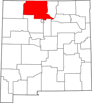
 Location within the U.S. state of New Mexico | |
 New Mexico's location within the U.S. | |
| Coordinates: 36°31′N 106°42′W / 36.51°N 106.7°W | |
| Country | |
| State | |
| Founded | 1852 |
| Named for | location on the upper Rio Grande (río arriba means "upriver" in Spanish) |
| Seat | Tierra Amarilla |
| Largest city | Española |
| Government | |
| • County Manager | Jeremy G. Maestas |
| Area | |
• Total | 5,896 sq mi (15,270 km2) |
| • Land | 5,861 sq mi (15,180 km2) |
| • Water | 35 sq mi (90 km2) 0.6% |
| Population (2020) | |
• Total | 40,363 |
| • Density | 6.8/sq mi (2.6/km2) |
| Time zone | UTC−7 (Mountain) |
| • Summer (DST) | UTC−6 (MDT) |
| Congressional district | 3rd |
| Website | www |
Rio Arriba County (Spanish: Condado de Río Arriba) is a county in the U.S. state of New Mexico. As of the 2020 census, the population was 40,363.[1] Its county seat is Tierra Amarilla.[2] Its northern border is the Colorado state line.
Rio Arriba County comprises the Española, NM Micropolitan Statistical Area, which is also included in the Albuquerque-Santa Fe-Las Vegas, NM Combined Statistical Area.
- ^ "Rio Arriba County, New Mexico". United States Census Bureau. Retrieved July 3, 2023.
- ^ "Find a County". National Association of Counties. Retrieved June 7, 2011.
Previous Page Next Page
مقاطعة ريو أريبا (نيومكسيكو) Arabic Rio Arriba County, New Mexico BAR Рио Ариба Bulgarian রিও আরিবা কাউন্টি, নিউ মেক্সিকো BPY Comtat de Rio Arriba Catalan Rio Arriba Gông (New Mexico) CDO Rio Arriba County CEB Rio Arriba County, Mecsico Newydd CY Rio Arriba County German Condado de Río Arriba Spanish


