Our website is made possible by displaying online advertisements to our visitors.
Please consider supporting us by disabling your ad blocker.
River Blackwater (River Test)
| Blackwater | |
|---|---|
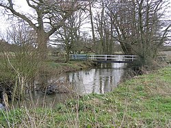
 River Blackwater east of Testwood Lakes | |
 | |
| Location | |
| Country | United Kingdom |
| Region | Wiltshire, Hampshire |
| Physical characteristics | |
| Source | |
| • location | Redlynch, Wiltshire |
| • coordinates | 50°59′23″N 1°42′44″W / 50.98972°N 1.71222°W |
| Mouth | Totton |
• location | Hampshire |
• coordinates | 50°55′36″N 1°29′31″W / 50.92667°N 1.49194°W |
| Length | 45.0 km (28.0 mi) |
| Basin size | 67.5 km2 (26.1 sq mi) |
This River Blackwater drains small parts of the English counties of Hampshire and Wiltshire. It is a tributary of the River Test.
Previous Page Next Page


