Our website is made possible by displaying online advertisements to our visitors.
Please consider supporting us by disabling your ad blocker.
Rue Neuve, Brussels
 The Rue Neuve/Nieuwstraat in Brussels | |
| Location | City of Brussels, Brussels-Capital Region, Belgium |
|---|---|
| Quarter | Marais–Jacqmain Quarter |
| Coordinates | 50°51′11″N 04°21′23″E / 50.85306°N 4.35639°E |
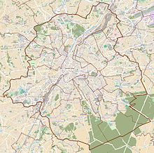
The Rue Neuve (French, pronounced [ʁy nœv]) or Nieuwstraat (Dutch, pronounced [ˈniustraːt]), meaning "New Street", is a pedestrian street in central Brussels, Belgium. It runs between the Place de la Monnaie/Muntplein and the Rue du Fossé aux Loups/Wolvengracht to the south and the Place Charles Rogier/Karel Rogierplein and the Boulevard du Jardin botanique/Kruidtuinlaan to the north.[1]
The Rue Neuve and its close surroundings are the second most popular shopping area in Belgium by number of shoppers, after Meir in Antwerp.[2] It is served by the metro and premetro (underground tram) stations De Brouckère (on lines 1, 3, 4 and 5) and Rogier (on lines 2, 3, 4 and 6).
- ^ "Rue Neuve – Inventaire du patrimoine architectural". monument.heritage.brussels (in French). Retrieved 4 November 2023.
- ^ "Meir klopt voor het eerst Nieuwstraat als drukste winkelstraat". De Standaard (in Dutch). Belga. 7 January 2013. Retrieved 11 September 2021.
Previous Page Next Page


