Our website is made possible by displaying online advertisements to our visitors.
Please consider supporting us by disabling your ad blocker.
Ruvuma Region
Ruvuma Region
Mkoa wa Ruvuma (Swahili) | |
|---|---|
|
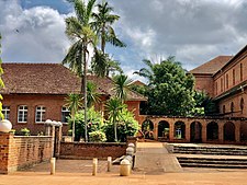
From top to bottom: Beach scen at Mbamba bay on Lake Nyasa, Peramiho Hospital in Songea & MV Iringa at the Port of Liuli | |
| Nickname: The pearl of Lake Nyasa | |
 Location in Tanzania | |
| Coordinates: 10°41′16.44″S 36°15′47.16″E / 10.6879000°S 36.2631000°E | |
| Country | |
| Zone | Southern Highlands |
| Capital | Songea |
| Districts | |
| Government | |
| • Regional Commissioner | Laban Elias Thomas (CCM) |
| Area | |
• Total | 63,669 km2 (24,583 sq mi) |
| • Land | 33,825 km2 (13,060 sq mi) |
| • Water | 29,844 km2 (11,523 sq mi) 46.8% |
| • Rank | 4th of 31 |
| Highest elevation (Lukukura) | 1,769 m (5,804 ft) |
| Population (2022) | |
• Total | 1,848,794 |
| • Rank | 19th of 31 |
| • Density | 29/km2 (75/sq mi) |
| Demonym | Ruvuman |
| Ethnic groups | |
| • Settler | Swahili |
| • Native | Makonde |
| Time zone | UTC+3 (EAT) |
| Postcode | 57xxx |
| Area code | 025 |
| ISO 3166 code | TZ-21[1] |
| HDI (2021) | 0.555[2] medium · 11th of 25 |
| Website | Official website |
| Symbols of Tanzania | |
| Bird |  |
| Butterfly | |
| Fish | |
| Mammal |  |
| Tree |  |
| Mineral | |
Ruvuma Region (Mkoa wa Ruvuma in Swahili) is one of Tanzania's 31 administrative regions. The region covers a land area of 63,669 km2 (24,583 sq mi), [3] comparable in size to the nation state of Latvia.[4] The region is also bordered to the north by the Morogoro Region, to the northeast by the Lindi Region, to the east by the Mtwara Region,the west by Lake Nyasa with Malawi and to the northwest by the Njombe Region. The regional capital is the municipality of Songea.
According to the 2012 national census, the region had a population of 1,376,891, which was lower than the pre-census projection of 1,449,830.[5] For 2002–2012, the region's 2.1 percent average annual population growth rate was the twentieth highest in the country.[5] It was also the 28th most densely populated region with 22 inhabitants per square kilometre (57/sq mi).[5]
- ^ "IS0 3166". ISO. Retrieved 2022-10-09.
- ^ "Sub-national HDI - Area Database - Global Data Lab". hdi.globaldatalab.org. Archived from the original on 2018-09-23. Retrieved 2020-02-26.
- ^ "History | Ruvuma Region". ruvuma.go.tz.
- ^ 64,589 km2 (24,938 sq mi) for Latvia at "Area size comparison". Nations Online. 2022. Retrieved 12 January 2023.
- ^ a b c "Population Distribution by Administrative Units, United Republic of Tanzania, 2013" (PDF). Archived from the original (PDF) on May 2, 2013.
Previous Page Next Page


