Our website is made possible by displaying online advertisements to our visitors.
Please consider supporting us by disabling your ad blocker.
Sans Bois Mountains
This article needs additional citations for verification. (February 2021) |
| Sans Bois Mountains | |
|---|---|
| Highest point | |
| Peak | Blue Mountain (Oklahoma) |
| Elevation | 1,831 ft (558 m) |
| Coordinates | 35°01′55″N 95°10′06″W / 35.031959°N 95.168324°W |
| Dimensions | |
| Length | 45 mi (72 km) E/W |
| Width | 19 mi (31 km) N/S |
| Area | 505 sq mi (1,310 km2) |
| Geography | |
| Country | United States |
| State | Oklahoma |
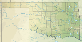
The Sans Bois Mountains are a small mountain range in southeastern Oklahoma and part of the larger Ouachita Mountains. The range is a frontal belt[definition needed] of the Ouachita Mountains and is located in Haskell and Latimer counties. Sans bois is a French term meaning 'without forest' or without wood' in English.[1][2][3][4]
- ^ "Sans Bois Mountains". Peakbagger.com. Retrieved January 13, 2013.
- ^ "San Bois Mountains". Encyclopedia of Oklahoma History and Culture.
- ^ "Sans Bois Mountains". Geographic Names Information System. United States Geological Survey, United States Department of the Interior. Retrieved December 15, 2012.
- ^ Wright, Muriel H. "Some Geographic Names of French Origin in Oklahoma." Chronicles of Oklahoma Volume7, Number 2. June, 1929. Accessed March 28, 2016.
Previous Page Next Page


