Our website is made possible by displaying online advertisements to our visitors.
Please consider supporting us by disabling your ad blocker.
Sheriff Street
 Sheriff Street, Dublin | |
| Native name | Sráid an tSirriam (Irish) |
|---|---|
| Namesake | Sheriffs in general |
| Length | 1.2 km (0.75 mi) |
| Width | 12 metres (39 ft) |
| Location | Dublin, Ireland |
| Postal code | D01 |
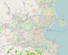
| Coordinates | 53°21′02″N 6°14′26″W / 53.350569°N 6.240527°W |
| west end | Commons Street |
| east end | East Wall Road |
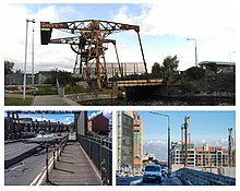
Sheriff Street (Irish: Sráid an tSirriam) is a street in the north inner city of Dublin, Ireland, lying between East Wall and North Wall and often considered to be part of the North Wall area. It is divided into Sheriff Street Lower (west end) and Sheriff Street Upper (east end).
Previous Page Next Page


