Our website is made possible by displaying online advertisements to our visitors.
Please consider supporting us by disabling your ad blocker.
Shimoga district
Shimoga district | |
|---|---|
| Shivamogga district | |
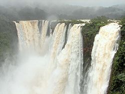
Clockwise from top-left: Aghoreshwara Temple in Ikkeri, View of Western Ghats near Kodachadri, Kedareswara Temple, Jog Falls, Kavaledurga Fort | |
| Nickname: Gateway to Malnad | |
 Location in Karnataka | |
| Coordinates: 14°00′N 75°17′E / 14.00°N 75.28°E | |
| Country | |
| State | |
| Administration Division | Bengaluru |
| Established | 1 November 1956 |
| Headquarters | Shimoga |
| Talukas | Shimoga, Sagara, Shikaripura, Soraba, Hosanagara, Bhadravathi, Thirthahalli |
| Government | |
| • Superintendent of Police | B. M. Lakshmi Prasad (IPS)[2] |
| • Deputy Commissioner and District Magistrate | Gurudatta Hegade (IAS)[2] |
| Area | |
• Total | 8,495 km2 (3,280 sq mi) |
| Population (2011) | |
• Total | 1,752,753[1] |
| • Density | 207/km2 (540/sq mi) |
| Languages | |
| • Official | Kannada |
| Time zone | UTC+5:30 (IST) |
| Vehicle registration | |
| Website | shimoga |
Shimoga district, officially known as Shivamogga district,[3] is a district in the Karnataka state of India. A major part of Shimoga district lies in the Malnad region or the Sahyadri. Shimoga city is its administrative centre. Jog Falls view point is a major tourist attraction. As of 2011 Shimoga district has a population of 17,52,753.[1] There are seven taluks: Soraba, Sagara, Hosanagar, Shimoga, Shikaripura, Thirthahalli, and Bhadravathi. Channagiri and Honnali were part of Shimoga district until 1997 when they became part of the newly formed Davanagere district.
- ^ a b "Shimoga:Census2011". census2011.co.in.
- ^ a b "Who's Who - District Shivamogga, Government of Karnataka - India". shimoga.nic.in. Retrieved 31 July 2022.
- ^ "Bangalore becomes 'Bengaluru'; 11 other cities renamed". The Economic Times. PTI. 1 November 2014. Retrieved 18 July 2018.
Previous Page Next Page


