Our website is made possible by displaying online advertisements to our visitors.
Please consider supporting us by disabling your ad blocker.
Shirakamut
40°51′38″N 44°09′10″E / 40.86056°N 44.15278°E
Shirakamut
Շիրակամուտ | |
|---|---|
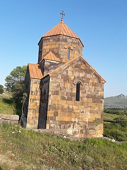
 Church in the village | |
| Coordinates: 40°51′38″N 44°09′10″E / 40.86056°N 44.15278°E | |
| Country | |
| Province | Lori |
| Elevation | 1,650 m (5,410 ft) |
| Population | |
• Total | 2,310 |
| Time zone | UTC+4 (AMT) |
Shirakamut or previously Nalband (Armenian: Շիրակամուտ) is a village in the Lori Province of Armenia. The town was the epicenter of 1988 Armenian earthquake.
Previous Page Next Page


