Our website is made possible by displaying online advertisements to our visitors.
Please consider supporting us by disabling your ad blocker.
Sincholagua Volcano
| Sincholagua Volcano | |
|---|---|
 Sincholagua Volcano | |
| Highest point | |
| Elevation | 4,899 m (16,073 ft) |
| Coordinates | 0°32′17″S 78°22′19″W / 0.53806°S 78.37194°W[1] |
| Geography | |
| Parent range | Andes |
| Geology | |
| Mountain type(s) | Stratovolcano, Historical |
| Last eruption | 1877 |
| Climbing | |
| First ascent | 23 February 1880 by Edward Whymper, Jean-Antoine Carrel and Louis Carrel |
| Easiest route | Scramble |
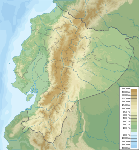
Sincholagua is an inactive volcano located in Ecuador 17 km (11 mi) northeast of Cotopaxi Volcano and 45 km (28 mi) southeast of Quito.[2] It is the 12th highest peak in the country at 4,899 m (16,073 ft) but also one of the lesser known ones. The name of the mountain comes from the indigenous language Quichua and means "strong above".[3] Due to its close proximity to Cotopaxi, the second highest peak in Ecuador and the most popular volcano, it is far less frequently visited compared to other mountains in the country. It has a sharp peak and at one point had glacial cover year round, but all of the glaciers melted a few decades ago. However, snow can still be seen on the peak since there is sometimes heavy snowfall at the summit.[4]
- ^ "Sincholagua". www.peakbagger.com. Retrieved 3 June 2023.
- ^ Rachoweicki, Rob and Mark Thurber. Ecuador: Climbing and Hiking Guide. Viva Pub. Network, 2008. p.208.
- ^ Brain, Yossi, Ecuador: A Climbing Guide, Seattle: Mountaineers, 2000. p.125.
- ^ http://www.summitpost.org/sincholagua/672776. Andean, Boriss. "Sincholagua: Climbing, Hiking, and Mountaineering". summitpost.com. 8/16/12, 9/29/13
Previous Page Next Page


