Our website is made possible by displaying online advertisements to our visitors.
Please consider supporting us by disabling your ad blocker.
Squantz Pond
| Squantz Pond | |
|---|---|
 Squantz Pond from the southern shore | |
| Location | New Fairfield, Connecticut |
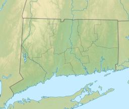
| Coordinates | 41°31′N 73°29′W / 41.52°N 73.48°W |
| Surface area | 288 acres (117 ha)[1] |
| Average depth | 22.9 ft (7.0 m)[1] |
| Max. depth | 47 ft (14 m)[1] |
| Water volume | 2,228,000,000 US gal (8.43×10⁹ L; 1.855×10⁹ imp gal)[1] |
Squantz Pond is a 288-acre lake in Fairfield County, Connecticut. It is located on the town line of Sherman and New Fairfield, and is bordered by manmade Candlewood Lake.[1] The south shore is protected as Squantz Pond State Park (established in 1926), and is managed by the Connecticut Department of Energy and Environmental Protection.[2] The pond is named for Chief Squantz, a leader of the Schaghticoke tribe.[3]
- ^ a b c d e "Environmental Review Team Report - Squantz Pond" (PDF). King's Mark Environmental Review Team Report. King's Mark Resource & Development Area. June 1983. Retrieved 21 September 2022.
- ^ "Squantz Pond State Park--Overview". CT.gov - Connecticut's Official State Website. Retrieved 21 September 2022.
- ^ Cite error: The named reference
CLAwas invoked but never defined (see the help page).
Previous Page Next Page


