Our website is made possible by displaying online advertisements to our visitors.
Please consider supporting us by disabling your ad blocker.
Sub-Balkan Valley

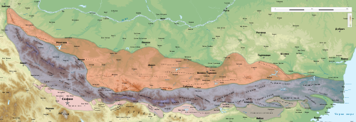
The Sub-Balkan Valleys (Bulgarian: Подбалкански котловини, romanized: Podbalkanski kotlovini) are row of 11 valleys running from the Bulgarian border with Serbia east to the Black Sea.[1] They are separating the Balkan Mountains from a chain of other mountains known as Srednogorie which includes Vitosha and Sredna Gora. There is great abundance of mineral waters. They are divided into two parts: Western (higher) and Eastern (lower). The western valleys include: Burel Valley; Sofia Valley; Saranska Valley; Kamarska Valley. The eastern valleys are: Zlatitsa–Pirdop Valley; Karlovo Valley; Kazanlak Valley; Tvarditsa Valley; Sliven Valley; Karnobat Valley; Aytos Valley.[2]
Previous Page Next Page


