Our website is made possible by displaying online advertisements to our visitors.
Please consider supporting us by disabling your ad blocker.
Sutla
| Sotla / Sutla | |
|---|---|
 | |
 | |
| Location | |
| Countries | |
| Physical characteristics | |
| Source | |
| • elevation | 580 m (1,900 ft) [1] |
| Mouth | |
• location | Sava |
• coordinates | 45°51′52″N 15°41′01″E / 45.8645°N 15.6835°E |
• elevation | 135 m (443 ft) [1] |
| Length | 88.6 km (55.1 mi) [2] |
| Basin size | 584.3 km2 (225.6 sq mi) [2] |
| Basin features | |
| Progression | Sava→ Danube→ Black Sea |
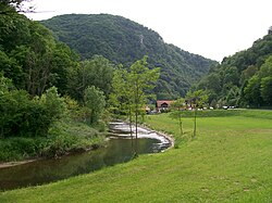
The Sutla (Croatian) or Sotla (Slovene) is a river flowing through Slovenia and Croatia, mostly forming their border. It is a tributary to the Sava, itself a tributary to the Danube. It is 89 kilometres (55 mi) long and has a watershed area of 584 square kilometres (225 sq mi).[2]
- ^ a b Rivers, longer than 25 km, and their catchment areas, Statistical Office of the Republic of Slovenia
- ^ a b c "Sava River Basin Analysis Report" (PDF). International Sava River Basin Commission. September 2009. p. 13. Archived from the original (PDF, 9.98 MB) on 2010-07-17.
Previous Page Next Page


