Our website is made possible by displaying online advertisements to our visitors.
Please consider supporting us by disabling your ad blocker.
Tablas Island
This article is written like a travel guide. (March 2018) |
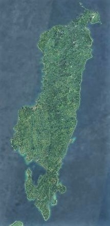
 Tablas island satellite image captured by Sentinel-2 in 2016 | |
| Geography | |
|---|---|
| Coordinates | 12°24′19″N 122°3′51″E / 12.40528°N 122.06417°E |
| Archipelago | Romblon Group of Islands |
| Adjacent to | |
| Area | 839.156 km2 (324.000 sq mi) |
| Highest elevation | 665 m (2182 ft) |
| Highest point | Tablas Peak |
| Administration | |
Philippines | |
| Region | Mimaropa |
| Province | Romblon |
| Municipalities | |
| Largest settlement | Odiongan (pop. 45,367) |
| Demographics | |
| Population | 164,012[1] (01 Aug 2015) |
| Additional information | |
 | |
Tablas is the largest of the islands that comprise the province of Romblon in the Philippines. The name of the island is of Spanish origin. Before the colonization of the Philippines, Tablas was known as the Island of Osigan. At the time of contact with Westerners, Osigan had a population of 256 people living in small villages. Wax was produced in this island.[2]
Odiongan, on the west central coast of the island, is a major port and the largest municipality of Romblon in terms of population.[1] Tablas is administratively subdivided into the municipalities of Alcantara, Calatrava, Ferrol, Looc, Odiongan, San Agustin, San Andres, Santa Fe, and Santa Maria.
- ^ a b = 175900000®Code = 17®Name = REGION+IV-B+%28Mimaropa%29 "Romblon Municipalities and Cities"[permanent dead link]. Philippine Standard Geographic Code Interactive. Retrieved on 2011-06-05.
- ^ Miguel de Loarca, Relacion de las Yslas Filipinas (Arevalo: June 1782) in BLAIR, Emma Helen & ROBERTSON, James Alexander, eds. (1903). The Philippine Islands, 1493–1803. Volume 05 of 55 (1582–1583). Historical introduction and additional notes by Edward Gaylord BOURNE. Cleveland, Ohio: Arthur H. Clark Company. ISBN 978-0554259598. OCLC 769945704. "Explorations by early navigators, descriptions of the islands and their peoples, their history and records of the catholic missions, as related in contemporaneous books and manuscripts, showing the political, economic, commercial and religious conditions of those islands from their earliest relations with European nations to the beginning of the nineteenth century.", p. 73.
Previous Page Next Page


