Our website is made possible by displaying online advertisements to our visitors.
Please consider supporting us by disabling your ad blocker.
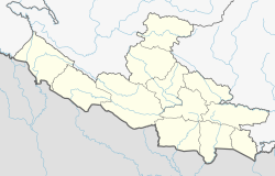
Tansen, Nepal
Tānsen
तानसेन | |
|---|---|
 Tansen | |
| Coordinates: 27°52′0″N 83°33′0″E / 27.86667°N 83.55000°E | |
| Country | |
| Province | Lumbini |
| District | Palpa |
| Municipality | Tansen |
| Government | |
| • Type | Mayor–council government |
| • Mayor | Mr.Santosh Lal Shrestha |
| • Deputy Mayor | Mrs. Pratichhya Sinjali |
| Elevation | 1,350 m (4,430 ft) |
| Population (2011 Census) | |
• Total | 31,095 |
| Time zone | UTC+5:45 (NST) |
| Postal code | 32500 |
| Area code | 075 |
| Website | tansenmun.gov.np |
Tansen is a Municipality and the administrative center of Palpa District in the "hills" of central Nepal. It is located on the highway between Butwal and Pokhara, on the crest of the Mahabharat Range or Lesser Himalaya overlooking the valley of the Kaligandaki River to the north.[1] The highway bypasses the town center on the west, protecting pedestrian amenities in the central maze of steep, narrow, winding alleys lined with Newari shophouses and temples.
- ^ "An Official Site of Tansen Municipality,Nepal". Archived from the original on 2011-03-24. Retrieved 2010-04-28.
Previous Page Next Page


