Our website is made possible by displaying online advertisements to our visitors.
Please consider supporting us by disabling your ad blocker.
Tarlac
Tarlac | |
|---|---|
(from top: left to right) Capas National Shrine, Tarlac Provincial Capitol, San Roque Church, Tarlac Cathedral, and Tarlac State University. | |
| Nickname: Melting Pot of Central Luzon | |
| Anthem: Awit ng Tarlac | |
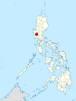
 Location within the Philippines | |
| Coordinates: 15°30′N 120°30′E / 15.5°N 120.5°E | |
| Country | Philippines |
| Region | Central Luzon |
| Founded | 28 May 1873 |
| Capital and largest city | Tarlac City |
| Government | |
| • Type | Sangguniang Panlalawigan |
| • Governor | Susan Y. Sulit (NPC) |
| • Vice Governor | Carlito S. David (NPC) |
| • Legislature | Tarlac Provincial Board |
| Area | |
• Total | 3,053.60 km2 (1,179.00 sq mi) |
| • Rank | 45th out of 81 |
| Highest elevation | 1,655 m (5,430 ft) |
| Population (2020 census)[2] | |
• Total | 1,503,456 |
| • Rank | 18th out of 81 |
| • Density | 490/km2 (1,300/sq mi) |
| • Rank | 13th out of 81 |
| Demonyms |
|
| Divisions | |
| • Independent cities | 0 |
| • Component cities | |
| • Municipalities | |
| • Barangays | 511 |
| • Districts | Legislative districts of Tarlac |
| Demographics (2000) | |
| • Ethnic groups | |
| • Languages | |
| Time zone | UTC+8 (PST) |
| IDD : area code | +63 (0)45 |
| ISO 3166 code | PH-TAR |
| Website | visit-tarlac.com |
Tarlac, officially the Province of Tarlac (Kapampangan: Lalawigan ning Tarlac; Pangasinan: Luyag/Probinsia na Tarlac; Ilocano: Probinsia ti Tarlac; Tagalog: Lalawigan ng Tarlac; [tɐɾˈlak]), is a landlocked province in the Philippines located in the Central Luzon region. Its capital is the city of Tarlac, which is the most populous in the province. It is bounded on the north by the province of Pangasinan, Nueva Ecija on the east, Zambales on the west, and Pampanga in the south. The province comprises three congressional districts and is subdivided into 17 municipalities and one city, Tarlac City, which is the provincial capital.
The province is situated in the heartland of Luzon, in what is known as the Central Plain also spanning the neighbouring provinces of Pampanga, Pangasinan, Nueva Ecija, and Zambales. Tarlac covers a total land area of 3,053.45 km2 (305,345 ha).
Early in history, what came to be known as Valenzuela Ranch today was once a thickly-forested area, peopled by roving tribes of nomadic Aetas who are said to be the aboriginal settlers of the Philippines, and for a lengthy period, it was the remaining hinterland of Luzon's Central Plains. Today, Tarlac is one of the most multi-cultural provinces in the region for having a mixture of four distinct ethnic groups: the Kapampangans, the Pangasinans, the Ilocanos, and the Tagalogs. It is also known for its fine food and vast sugar and rice plantations in Central Luzon.[4]
- ^ "List of Provinces". PSGC Interactive. Makati City, Philippines: National Statistical Coordination Board. Retrieved 21 August 2013.
- ^ Census of Population (2020). "Region III (Central Luzon)". Total Population by Province, City, Municipality and Barangay. Philippine Statistics Authority. Retrieved 8 July 2021.
- ^ "Tarlac: Population Reached a Million Mark (Results from the 2000 Census of Population and Housing, NSO)". Philippine Statistics Authority. August 13, 2002. Retrieved 15 December 2015.
- ^ "History of Tarlac". Tarlac Province Official Portal. Archived from the original on 22 January 2016. Retrieved 30 August 2015.
Previous Page Next Page


