Our website is made possible by displaying online advertisements to our visitors.
Please consider supporting us by disabling your ad blocker.
Thaba-Tseka District
Thaba-Tseka | |
|---|---|
 | |
| Nickname: Lilala | |
 Map of Lesotho with the district highlighted | |
| Country | |
| Capital | Thaba-Tseka |
| Area | |
• Total | 4,270 km2 (1,650 sq mi) |
| Population (2016) | |
• Total | 135,347 |
| • Density | 32/km2 (82/sq mi) |
| Time zone | UTC+2 (CAT) |
| Area code | +266 |
| HDI (2019) | 0.451[1] low · 10th |
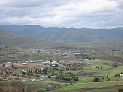
Thaba-Tseka is a district of Lesotho. Thaba-Tseka is also the name of the district's capital or camptown, which is the only town in the district. In the east, Thaba-Tseka borders on the KwaZulu-Natal Province of South Africa. Domestically, it borders on Mokhotlong District in northeast, Leribe District in north, Berea District in northwest, Maseru District in west, Mohale's Hoek District in southwest and Qacha's Nek District in the southern direction. The district is one of the major tourist attractions in Lesotho because of the second largest arch dam in Africa Katse Dam.
As of 2016, the district had a population of 135,347 which was 6.92 per cent of the total population of the country. The total area of the district was 4,270 which was 14.07 per cent of the total area of the country. The density of population in the district was 30.00 per km2. As of 2008, there were 38 per cent economically active people in the district. There were totally 77,836 employed people out of a total of 156,640 people in the district above 15 years of age.
- ^ "Sub-national HDI - Area Database - Global Data Lab". hdi.globaldatalab.org. Retrieved 2018-09-13.
Previous Page Next Page


