Our website is made possible by displaying online advertisements to our visitors.
Please consider supporting us by disabling your ad blocker.
The Mound
 View up the Mound towards the Bank of Scotland | |
| Former name(s) | The Earthen Mound |
|---|---|
| Length | 380 m (1,250 ft) (including The Mound and North Bank Street) |
| Postal code | EH1 |
| Coordinates | 55°57′0.28″N 3°11′44.13″W / 55.9500778°N 3.1955917°W |
| North (bottom) end | Princes Street |
| South (top) end | Bank Street/Royal Mile |
| Construction | |
| Completion | 1827 |
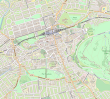
The Mound is an artificial slope and road in central Edinburgh, Scotland, which connects Edinburgh's New and Old Towns. It was formed by dumping around 1,501,000 cartloads of earth excavated from the foundations of the New Town into Nor Loch, which was drained in 1765 and forms today's Princes Street Gardens.
Previous Page Next Page


