Our website is made possible by displaying online advertisements to our visitors.
Please consider supporting us by disabling your ad blocker.
Tydal Municipality
Tydal Municipality
Tydal kommune | |
|---|---|
| Tydalen herred (historic name) | |
 | |
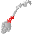
 Trøndelag within Norway | |
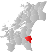
 Tydal within Trøndelag | |
| Coordinates: 63°01′06″N 11°48′54″E / 63.01833°N 11.81500°E | |
| Country | Norway |
| County | Trøndelag |
| District | Neadalen |
| Established | 1 Jan 1901 |
| • Preceded by | Selbu Municipality |
| Administrative centre | Ås |
| Government | |
| • Mayor (2019) | Jens Arne Kvello (Sp) |
| Area | |
• Total | 1,328.66 km2 (513.00 sq mi) |
| • Land | 1,217.37 km2 (470.03 sq mi) |
| • Water | 111.27 km2 (42.96 sq mi) 8.4% |
| • Rank | #75 in Norway |
| Highest elevation | 1,762.35 m (5,781.99 ft) |
| Population (2024) | |
• Total | 773 |
| • Rank | #346 in Norway |
| • Density | 0.6/km2 (2/sq mi) |
| • Change (10 years) | |
| Demonym | Tydaling[2] |
| Official language | |
| • Norwegian form | Bokmål |
| Time zone | UTC+01:00 (CET) |
| • Summer (DST) | UTC+02:00 (CEST) |
| ISO 3166 code | NO-5033[4] |
| Website | Official website |
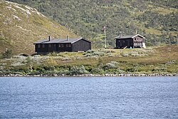
Tydal is a municipality in Trøndelag county, Norway. It is located in the Neadalen/Tydalen valley. The administrative centre of the municipality is the village of Ås. Other villages include Østby, Græsli, Aungrenda, and Stugudalen. There is a school and a kindergarten in Tydal.
The 1,329-square-kilometre (513 sq mi) municipality is the 75th largest by area out of the 357 municipalities in Norway. Tydal is the 346th most populous municipality in Norway with a population of 773. The municipality's population density is 0.6 inhabitants per square kilometre (1.6/sq mi) and its population has decreased by 10.5% over the previous 10-year period.[5][6]
The inhabitants of Tydal earn a living in the areas of farming, forestry, energy production, and tourism. During Easter, the number of people in Tydal Municipality increases by up to 5,000 people. Many people from Trondheim celebrate their holidays in the 1,400 cabins located throughout the municipality.
- ^ "Høgaste fjelltopp i kvar kommune" (in Norwegian). Kartverket. 16 January 2024.
- ^ "Navn på steder og personer: Innbyggjarnamn" (in Norwegian). Språkrådet.
- ^ "Forskrift om målvedtak i kommunar og fylkeskommunar" (in Norwegian). Lovdata.no.
- ^ Bolstad, Erik; Thorsnæs, Geir, eds. (9 January 2024). "Kommunenummer". Store norske leksikon (in Norwegian). Foreningen Store norske leksikon.
- ^ Statistisk sentralbyrå. "Table: 06913: Population 1 January and population changes during the calendar year (M)" (in Norwegian).
- ^ Statistisk sentralbyrå. "09280: Area of land and fresh water (km²) (M)" (in Norwegian).
Previous Page Next Page


