Our website is made possible by displaying online advertisements to our visitors.
Please consider supporting us by disabling your ad blocker.
Vanua Balavu
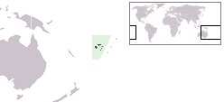
 Location in the Lau Group | |
 | |
| Geography | |
|---|---|
| Location | Fiji |
| Coordinates | 17°14′S 178°57′W / 17.233°S 178.950°W |
| Archipelago | Northern Lau Islands |
| Adjacent to | Koro Sea |
| Total islands | 1 |
| Major islands | 1 |
| Area | 57 km2 (22 sq mi)[1] |
| Length | 21 km (13 mi) |
| Highest elevation | 283 m (928 ft) |
| Administration | |
Fiji | |
| Division | Eastern |
| Province | Lau Province |
| Sub-Province | Northern Lau Islands |
| Largest settlement | Lomaloma (pop. 250) |
| Demographics | |
| Population | 1200 (2014) |
| Pop. density | 21.05/km2 (54.52/sq mi) |
| Ethnic groups | Native Fijians, Indo-Fijians ; other (Asian, Europeans, other Pacific Islander) |

Vanua Balavu (pronounced [βaˈnua mbaˈlaβu]) is the third largest island in Fiji's Lau archipelago, and the main island of the Northern Lau Group.
- ^ Gillespie, Rosemary G.; D. A. Clague (2009). Encyclopedia of Islands. University of California Press. p. 299. ISBN 978-0520256491. Retrieved 18 March 2014.
Previous Page Next Page


