Our website is made possible by displaying online advertisements to our visitors.
Please consider supporting us by disabling your ad blocker.
Willamette Valley
| Willamette Valley | |
|---|---|
 Farmscape in northern Polk County | |
 The Willamette Valley contains most of Oregon's population; it extends from the Portland metro area in the north to Eugene in the south. | |
| Geography | |
| Location | United States, Oregon |
| Borders on | Cascade Range (East) Oregon Coast Range (West) Calapooya Mountains (South) |
| Coordinates | 44°54′N 123°06′W / 44.9°N 123.1°W |
| Rivers | Willamette River |

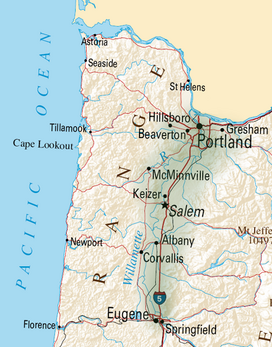
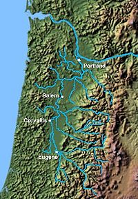
The Willamette Valley (/wɪˈlæmɪt/ ⓘ wil-AM-it) is a 150-mile (240 km) long valley in Oregon, in the Pacific Northwest region of the United States. The Willamette River flows the entire length of the valley and is surrounded by mountains on three sides: the Cascade Range to the east, the Oregon Coast Range to the west, and the Calapooya Mountains to the south.
The valley is synonymous with the cultural and political heart of Oregon and is home to approximately 70 percent of its population[1] including the five largest cities in the state: Portland, Eugene, Salem, Gresham, and Hillsboro.[2]
The valley's numerous waterways, particularly the Willamette River, are vital to the economy of Oregon, as they continuously deposit highly fertile alluvial soils across its broad, flat plain. A massively productive agricultural area, the valley was widely publicized in the 1820s as a "promised land of flowing milk and honey". Throughout the 19th century, it was the destination of choice for the oxen-drawn wagon trains of emigrants who made the perilous journey along the Oregon Trail.
Today, the valley is often considered synonymous with "Oregon Wine Country", as it contains more than 19,000 acres (7,700 ha) of vineyards and 500+ wineries.[3]
- ^ Loy, et al., p. 35
- ^ "American FactFinder - Results". Archived from the original on 13 February 2020.
- ^ "Willamette Valley Facts and Figures - Willamette Valley Wineries". willamettewines.com. Retrieved 29 April 2018.
Previous Page Next Page


