Our website is made possible by displaying online advertisements to our visitors.
Please consider supporting us by disabling your ad blocker.
Wolverhampton Airport
Wolverhampton Halfpenny Green Airport Bobbington Airport | |||||||||||||||||||
|---|---|---|---|---|---|---|---|---|---|---|---|---|---|---|---|---|---|---|---|
 | |||||||||||||||||||
| Summary | |||||||||||||||||||
| Airport type | Public | ||||||||||||||||||
| Operator | Wolverhampton Airport Ltd. | ||||||||||||||||||
| Serves | Wolverhampton | ||||||||||||||||||
| Location | Bobbington, South Staffordshire | ||||||||||||||||||
| Elevation AMSL | 283 ft / 86 m | ||||||||||||||||||
| Coordinates | 52°31′04″N 002°15′35″W / 52.51778°N 2.25972°W | ||||||||||||||||||
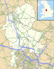
| Map | |||||||||||||||||||
 | |||||||||||||||||||
| Runways | |||||||||||||||||||
| |||||||||||||||||||
Wolverhampton Halfpenny Green Airport (ICAO: EGBO), formerly Halfpenny Green Airport and Wolverhampton Business Airport, locally Bobbington Airport, is a small, 400-acre (1.6 km2) airport situated near the village of Bobbington, South Staffordshire. The airport is situated 8 mi (13 km) south-west of Wolverhampton, the city which it serves.
Wolverhampton Airport has a CAA Public Use Aerodrome Licence (Number P872) that allows flights for the public transport of passengers or for flying instruction.
- ^ a b c Delve 2007, p. 129.
- ^ "Wolverhampton – EGBO". 9 January 2013. Retrieved 28 May 2016.
Previous Page Next Page


