Our website is made possible by displaying online advertisements to our visitors.
Please consider supporting us by disabling your ad blocker.
Wonju Airport
Wonju Airport 원주공항 | |||||||||||
|---|---|---|---|---|---|---|---|---|---|---|---|
 | |||||||||||
| Summary | |||||||||||
| Airport type | Public / Military | ||||||||||
| Owner | Ministry of Land, Infrastructure and Transport | ||||||||||
| Operator | |||||||||||
| Serves | Wonju | ||||||||||
| Location | Hoengseong County, Gangwon, South Korea | ||||||||||
| Opened | 28 February 1997 | ||||||||||
| Elevation AMSL | 330 ft / 101 m | ||||||||||
| Coordinates | 37°27′33″N 127°58′37″E / 37.45917°N 127.97694°E | ||||||||||
| Website | www | ||||||||||
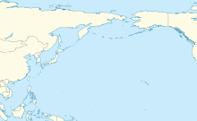
| Map | |||||||||||
 | |||||||||||
| Runways | |||||||||||
| |||||||||||
| Statistics (2019) | |||||||||||
| |||||||||||
Source:airport.kr[1] | |||||||||||
| Wonju Airport | |
| Hangul | 원주공항 |
|---|---|
| Hanja | 原州空港 |
| Revised Romanization | Wonju Gonghang |
| McCune–Reischauer | Wŏnju Konghang |
Wonju Airport (IATA: WJU, ICAO: RKNW) is an airport in Hoengseong County, Gangwon, South Korea. During the Korean War it was designated K-46 (Hoengseong Air Base) by the United States Air Force. In 2011, 70,943 passengers used the airport, which is mainly for military use.[1]
- ^ a b "South Korea Traffic Statistics". airport.kr.com.
Previous Page Next Page


