Our website is made possible by displaying online advertisements to our visitors.
Please consider supporting us by disabling your ad blocker.
Yamanashi Prefecture
Yamanashi Prefecture
山梨県 | |
|---|---|
| Japanese transcription(s) | |
| • Japanese | 山梨県 |
| • Rōmaji | Yamanashi-ken |
 | |
| Anthem: Yamanashi-ken no uta | |
 | |
| Country | |
| Region | Chūbu (Kōshin'etsu) (Tōkai) |
| Island | Honshu |
| Capital | Kōfu |
| Subdivisions | Districts: 5, Municipalities: 27 |
| Government | |
| • Governor | Kotaro Nagasaki (from February 2019) |
| Area | |
• Total | 4,465.27 km2 (1,724.05 sq mi) |
| • Rank | 32nd |
| Highest elevation | 3,778 m (12,395 ft) |
| Population (January 1, 2019) | |
• Total | 817,192 |
| • Rank | 41st |
| • Density | 183/km2 (470/sq mi) |
| • Dialects | Gun'nai・Koshu・Narada |
| GDP | |
| • Total | JP¥ 3,566 billion US$ 32.7 billion (2019) |
| ISO 3166 code | JP-19 |
| Website | www |
| Symbols of Japan | |
| Bird | Uguisu (bush warbler) |
| Flower | Fujizakura (Fuji cherry) |
| Tree | Kaede (Japanese maple) |
Yamanashi Prefecture (山梨県, Yamanashi-ken) is a prefecture of Japan located in the Chūbu region of Honshu.[2] Yamanashi Prefecture has a population of 817,192 (1 January 2019) and has a geographic area of 4,465 km2 (1,724 sq mi). Yamanashi Prefecture borders Saitama Prefecture to the northeast, Nagano Prefecture to the northwest, Shizuoka Prefecture to the southwest, Kanagawa Prefecture to the southeast, and Tokyo to the east.
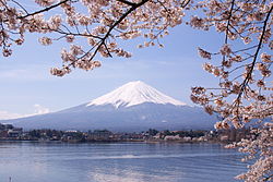
Kōfu is the capital and largest city of Yamanashi Prefecture, with other major cities including Kai, Minamiarupusu, and Fuefuki.[3] Yamanashi Prefecture is one of only eight landlocked prefectures, and the majority of the population lives in the central Kōfu Basin surrounded by the Akaishi Mountains, with 27% of its total land area being designated as Natural Parks. Yamanashi Prefecture is home to many of the highest mountains in Japan, and Mount Fuji, the tallest mountain in Japan and cultural icon of the country, is partially located in Yamanashi Prefecture on the border with Shizuoka Prefecture.

- ^ "2020年度国民経済計算(2015年基準・2008SNA) : 経済社会総合研究所 - 内閣府". 内閣府ホームページ (in Japanese). Retrieved 2023-05-18.
- ^ Nussbaum, Louis-Frédéric. (2005). "Yamanashi-ken" in Japan Encyclopedia, p. 1044, p. 1044, at Google Books; "Chūbu" in p. 126, p. 126, at Google Books
- ^ 甲府市; Introduction of Kofu City; retrieved 2011-07-13
Previous Page Next Page


