Our website is made possible by displaying online advertisements to our visitors.
Please consider supporting us by disabling your ad blocker.
Zarghun Ghar
30°07′N 67°48′E / 30.117°N 67.800°E
| Zarghoon | |
|---|---|
 | |
| Highest point | |
| Elevation | 3,578 m (11,739 ft)[1] |
| Geography | |
| Location | Pakistan |
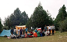
Zarghun Ghar (Pashto: زرغون غر, lit. "Green Mountain"), or Zarghoon Mountains, is a mountain range located in the east of Quetta District, in Balochistan Province of western Pakistan. The range, which is part of the Sulaiman Range, contains the tallest mountain peak in Balochistan. The range is home to a broad swathe of flora and fauna.

- ^ "Highest Mountains Peak in Baluchistan and Quetta". Chiltan Adventures Association Balochistan.com. Retrieved 27 September 2010.
Previous Page Next Page


