Our website is made possible by displaying online advertisements to our visitors.
Please consider supporting us by disabling your ad blocker.
Stahnsdorf
| Municipio | ||
 Iglesia de Stahnsdorf
| ||
 | ||
|
Ubicación en el estado de Brandeburgo | ||
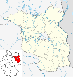
 Ubicación en el distrito | ||
| Coordenadas | 52°22′53″N 13°12′44″E / 52.381339, 13.21221 | |
|---|---|---|
| Entidad | Municipio | |
| • País | Alemania | |
| • Estado | Brandeburgo | |
| • Distrito | Potsdam-Mittelmark | |
| Superficie | ||
| • Total | 49,07 km² | |
| Altitud | ||
| • Media | 44 m s. n. m. | |
| Población (2023) | ||
| • Total | 16 266 hab. | |
| • Densidad | 328,81 hab./km² | |
| Huso horario | UTC+01:00 y UTC+02:00 | |
| Código postal | 14532[1] | |
| Prefijo telefónico | 03329 | |
| Matrícula | PM | |
| Número oficial de comunidad | 12069604 | |
| Sitio web oficial | ||
Stahnsdorf es un municipio situado en el distrito de Potsdam-Mittelmark, en el estado federado de Brandeburgo (Alemania), a una altitud de 44 metros. Su población a finales de 2016 era de unos 15 000 habs. y su densidad poblacional, 300 hab/km².[2][3]
- ↑ Worldpostalcodes.org, código postal n.º 14532.
- ↑ [1] Estadísticas bundestag. Consultado el 7 de junio de 2018
- ↑ [2] Archivado el 12 de junio de 2018 en Wayback Machine. Página web oficial de Potsdam-Mittelmark. Consultado el 7 de junio de 2018
Previous Page Next Page


