Our website is made possible by displaying online advertisements to our visitors.
Please consider supporting us by disabling your ad blocker.
Thevray
| Thevray comune delegato | |
|---|---|
 | |
| Localizzazione | |
| Stato | |
| Regione | |
| Dipartimento | |
| Arrondissement | Bernay |
| Cantone | Bernay |
| Comune | Mesnil-en-Ouche |
| Territorio | |
| Coordinate | 48°59′N 0°44′E |
| Altitudine | 133 e 188 m s.l.m. |
| Superficie | 15,27 km² |
| Abitanti | 297[1] (2009) |
| Densità | 19,45 ab./km² |
| Altre informazioni | |
| Cod. postale | 27330 |
| Fuso orario | UTC+1 |
| Codice INSEE | 27628 |
| Cartografia | |
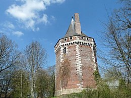
Thevray è un ex comune francese di 297 abitanti situato nel dipartimento dell'Eure nella regione della Normandia. Dal 1º gennaio 2016 è stato incorporato con altri 15 comuni per formare il nuovo comune di Mesnil-en-Ouche, divenendo comune delegato.
Previous Page Next Page


