Our website is made possible by displaying online advertisements to our visitors.
Please consider supporting us by disabling your ad blocker.
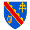
County Armagh
County Armagh
| |
|---|---|
 | |
| Country | United Kingdom |
| Region | Northern Ireland |
| Province | Ulster |
| County town | Armagh |
| Area | |
| • Total | 512 sq mi (1,326 km2) |
| • Rank | 27th |
| Population (2011) | 174,792 |
| • Rank | 11th[1] |
| Contae Ard Mhacha is the Irish name; Coontie Armagh[2] and Coontie Airmagh[3] are Ulster Scots spellings. | |
County Armagh is one of six counties that together make up Northern Ireland. It is also one of the 32 counties of Ireland. County Armagh lies in the north-east of the island of Ireland. The county is 1,326 km²[4] big. About 174,792 people live there.
The county is named after the city Armagh. The name "Armagh" comes from the Irish word Ard meaning "high place" and Macha. In stories, Macha is a goddess of Ireland. Armagh was the main town for the historic Ulaid kings of Ulster.
- ↑ Census figures are no longer released detailing returns for Counties but rather Parliamentary Constituency, Local Government District, Electoral Ward and Output Area. This figure is based on a tally of all persons resident in the wards comprising County Armagh on 29 April 2001, i.e. all electoral wards of the Newry & Armagh Parliamentary Constituency (minus St. Mary's, St. Patrick's and Windsor Hill from County Down) combined with the 17 wards in the Upper Bann Parliamentary Constituency from County Armagh (i.e. Derrytrasna, Birches, Bleary, Drumgask, Taghnevan, Court, Annagh, Brownstown, Ballybay, Ballyoran, Corcrain, Edenderry, Killycomain, Kernan, Drumgor, Mourneview, Church, Knocknashane, Parklane, Woodville, Drumnamoe, and Tavanagh). "Area Profiles". Northern Ireland Neighbourhood Information Service. Retrieved 8 August 2008.
- ↑ Tourism Ireland: 2007 Yearly Report in Ulster Scots Archived 17 July 2012 at the Wayback Machine
- ↑ North-South Ministerial Council: 2006 Annual Report in Ulster Scots Archived 27 February 2013 at the Wayback Machine
- ↑ County Armagh, Land Area
Previous Page Next Page


