Our website is made possible by displaying online advertisements to our visitors.
Please consider supporting us by disabling your ad blocker.
Fargo, North Dakota
Fargo, North Dakota | |
|---|---|
Downtown Fargo Plains Art Museum Fargo Civic Center Veterans Memorial Bridge Fargo Air Museum Cathedral of St. Mary | |
| Coordinates: 46°52′24″N 96°49′38″W / 46.87333°N 96.82722°W | |
| Country | United States |
| State | North Dakota |
| County | Cass |
| Founded | 1871 |
| Named for | William Fargo |
| Government | |
| • Mayor | Tim Mahoney (D) |
| Area | |
| • City | 50.77 sq mi (131.49 km2) |
| Elevation | 906 ft (276 m) |
| Population | |
| • City | 125,990 |
| • Rank | US: 216th ND: 1st |
| • Density | 2,481.68/sq mi (958.19/km2) |
| • Urban | 216,214 (US: 177th)[2] |
| • Urban density | 2,781.6/sq mi (1,074.0/km2) |
| • Metro | 258,663 (US: 190th) |
| • Demonym | Fargoan |
| Time zone | UTC-6 (Central) |
| ZIP Codes | 58102–58109, 58121–58122, 58124–58126 |
| Area code | 701 |
| FIPS code | 38-25700 |
| GNIS feature ID | 1036030[3] |
| Website | fargond.gov |
Fargo is the is the county seat of Cass County. The city was founded in 1871, and it has a population of 125,990 as of the 2020 census. This makes it the largest city in the American state of North Dakota. It is the 216th largest city in America.[4]
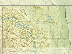
Fargo is in the eastern part of the state, near the Minnesota border. Fargo is at the intersection of two major highways, Interstate 29 and Interstate 94. Fargo has a twin city of Moorhead, Minnesota. Fargo, Moorhead, West Fargo, and Dilworth, Minnesota, are part of the Fargo-Moorhead Metropolitan Statistical Area.
Fargo was founded in 1871 on the Red River of the North floodplain.[5] Fargo is very important to North Dakota. It is a cultural, retail, health care, education, and industry center in the Midwest. North Dakota State University is in the city.
- ↑ "ArcGIS REST Services Directory". United States Census Bureau. Retrieved September 20, 2022.
- ↑ "List of 2020 Census Urban Areas". census.gov. United States Census Bureau. Retrieved January 7, 2023.
- ↑ 3.0 3.1 U.S. Geological Survey Geographic Names Information System: Fargo, North Dakota
- ↑ 4.0 4.1 "Profile of General Population and Housing Characteristics: 2020 Demographic Profile Data (DP-1): Fargo city, North Dakota". United States Census Bureau. Retrieved February 18, 2024.
- ↑ John Eligon (April 2, 2013). "Sandbag Season Has Fargo Thinking of a Better Way". The New York Times. Retrieved April 3, 2013.
"When you have a 100-year flood four years out of five, that's a great challenge," Gov. Jack Dalrymple said.
Previous Page Next Page


