Our website is made possible by displaying online advertisements to our visitors.
Please consider supporting us by disabling your ad blocker.
Lower Egypt

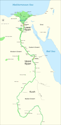
Lower Egypt is the fertile Nile Delta region, which stretches from the area between El-Aiyat and Zawyet Dahshur, south of modern-day Cairo, and the Mediterranean Sea.
Lower Egypt was known as Ta-Mehu which means "land of papyrus." It was divided into twenty districts called nomes. Lower Egypt was mostly undeveloped scrubland, undeveloped for human life and filled with all types of plant life such as grasses and herbs.
The climate in Lower Egypt is milder than that of Upper Egypt. Temperatures are less extreme and there is more rainfall.
The capital of Lower Egypt was Buto. Its patron goddess was the cobra goddess Wadjet. Lower Egypt was represented by the Low Red Crown Deshret, and its symbol was the papyrus.
Previous Page Next Page


