Our website is made possible by displaying online advertisements to our visitors.
Please consider supporting us by disabling your ad blocker.
Manhattan, Kansas
Manhattan, Kansas | |
|---|---|
City and County seat | |
 Riley County Courthouse (2005) | |
| Nickname(s): | |
 Location within Riley County and Kansas | |
 | |
| Coordinates: 39°11′19″N 96°36′17″W / 39.18861°N 96.60472°W[3] | |
| Country | United States |
| State | Kansas |
| Counties | Riley, Pottawatomie |
| Founded | 1855 |
| Incorporated | 1857 |
| Government | |
| • Type | Commission-Manager |
| Area | |
| • City and County seat | 19.98 sq mi (51.75 km2) |
| • Land | 19.92 sq mi (51.60 km2) |
| • Water | 0.06 sq mi (0.16 km2) |
| • Metro | 18.88 sq mi (48.89 km2) |
| Elevation | 1,056 ft (322 m) |
| Population | |
| • City and County seat | 54,100 |
| • Density | 2,700/sq mi (1,000/km2) |
| Time zone | UTC−6 (CST) |
| • Summer (DST) | UTC−5 (CDT) |
| ZIP codes | 66502–66503, 66505-66506 |
| Area code | 785 |
| FIPS code | 20-44250 |
| GNIS ID | 485618[3] |
| Website | cityofmhk.com |
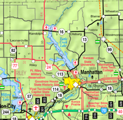
Manhattan is a city in the state of Kansas in the United States. It is at the junction of the Kansas River and Big Blue River. It is the county seat of Riley County.[7] The city extends into Pottawatomie County. In 2020, 54,100 people lived there.[6] It is sometimes confused with Manhattan, New York.
The city was created by settlers from the New England Emigrant Aid Company. They created it as a Free-State town in the 1850s. This was during the Bleeding Kansas era. It is nicknamed "The Little Apple" as a play on New York City's "Big Apple". Manhattan is best known as where Kansas State University is. It is a college town.
Fort Riley, a United States Army base, is 8 miles (13 km) west of Manhattan.
- ↑ Hook, J. N. (June 10, 2014). All Those Wonderful Names. Open Road Media. p. 255. ISBN 978-1-4976-1186-3.
- ↑ "Little Apple... BIG HISTORY". manhattancvb.com. Manhattan Convention and Visitors Bureau. Retrieved October 3, 2018.
- ↑ 3.0 3.1 3.2 U.S. Geological Survey Geographic Names Information System: Manhattan, Kansas
- ↑ Cite error: The named reference
CenPopGazetteer2020was used but no text was provided for refs named (see the help page). - ↑ Cite error: The named reference
DP1was used but no text was provided for refs named (see the help page). - ↑ 6.0 6.1 "QuickFacts: Manhattan city, Kansas". United States Census Bureau. Retrieved December 14, 2023.
- ↑ "Find a County". National Association of Counties. Archived from the original on May 31, 2011. Retrieved June 7, 2011.
Previous Page Next Page


