Our website is made possible by displaying online advertisements to our visitors.
Please consider supporting us by disabling your ad blocker.
Nagaland
Nagaland | |
|---|---|
State of India | |
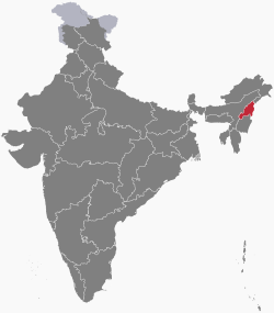
 Location of Nagaland in India | |
 Map of Nagaland | |
| Country | |
| Region | Northeast India |
| Area | |
| • Total | 16,579 km2 (6,401 sq mi) |
| Population (2011) | |
| • Total | 1,978,502[1] |
| Time zone | UTC+05:30 (IST) |
Nagaland is a northeastern state in the Republic of India. It has an area of 6,401 square miles (16,580 km2). It is bigger than East Timor but smaller than Eswatini. In traditional Indian geography it falls under the North-east Indian zone.
- ↑ "Nagaland Population 2011 - 2022". www.census2011.co.in. Retrieved 2022-03-06.
Previous Page Next Page


