Our website is made possible by displaying online advertisements to our visitors.
Please consider supporting us by disabling your ad blocker.
Argyll and Bute
Argyll and Bute Earra-Ghaidheal agus Bòd | |
|---|---|
Scottish council area, lieutenancy area of Scotland | |
 | |
 | |
 | |
| Mga koordinado: 55°59′N 5°27′W / 55.98°N 5.45°W | |
| Bansa | |
| Lokasyon | Eskosya |
| Itinatag | 1 Abril 1996 |
| Kabisera | Lochgilphead |
| Lawak | |
| • Kabuuan | 6,908.6739 km2 (2,667.4539 milya kuwadrado) |
| Populasyon (2019)[1] | |
| • Kabuuan | 85,870 |
| • Kapal | 12/km2 (32/milya kuwadrado) |
| Kodigo ng ISO 3166 | GB-AGB |
| Websayt | http://www.argyll-bute.gov.uk/ |
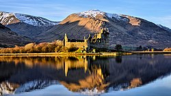
Ang Argyll and Bute ay isang council area sa kanlurang bahagi ng Eskosya. Napapaligiran ito ng mga council areas ng: Highland, Perth and Kinross, Stirling at West Dunbartonshire.[2]
Previous Page Next Page


