Our website is made possible by displaying online advertisements to our visitors.
Please consider supporting us by disabling your ad blocker.
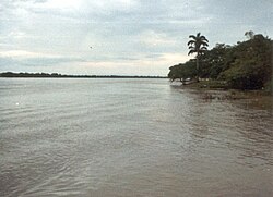
Apure River
| Apure | |
|---|---|
 Bridge over the Apure River, San Fernando, Venezuela | |
 | |
| Location | |
| Countries | |
| Physical characteristics | |
| Source | |
| • location | Venezuela |
| • elevation | 3,912 m (12,835 ft) (Páramo Batallón) |
| Mouth | |
• location | Orinoco 20 km (12 mi) west of Cabruta |
• coordinates | 7°40′N 66°25′W / 7.667°N 66.417°W |
| Length | 1,038 km (645 mi) |
| Basin size | 167,000 km2 (64,000 sq mi)[1] |
| Discharge | |
| • average | 2,300 m3/s (81,000 cu ft/s) |
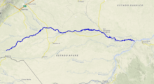
The Apure River is a river of southwestern Venezuela, formed by the confluence of the Sarare and Uribante near Guasdualito, in Venezuela, at 7°15′N 70°40′W / 7.250°N 70.667°W, and flowing across the Llanos into the Orinoco. It provides significant transportation in the area.
- ^ Saunders, James F., III and Lewis, William M., Jr. (October 1988) "Transport of phosphorus, nitrogen, and carbon by the Apure River, Venezuela" Biogeochemistry 5(3): pp. 323–342
Previous Page Next Page


