Our website is made possible by displaying online advertisements to our visitors.
Please consider supporting us by disabling your ad blocker.
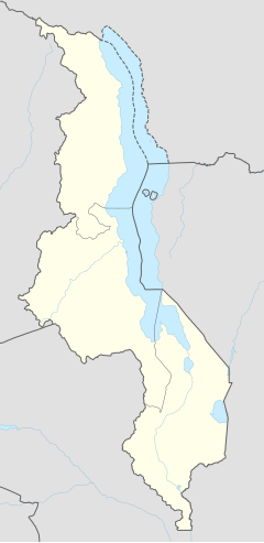
Balaka Township, Malawi
Balaka District council | |
|---|---|
| Coordinates: 14°55′S 34°52′E / 14.917°S 34.867°E | |
| Country | Malawi |
| Region | Southern Region |
| District | Balaka District |
| Population (2018 Census[1]) | |
• Total | 36,308 |
| Time zone | +2 |
| Climate | Aw |
| Website | https://www.balakadc.com/ |
Balaka is a township in Southern Region, Malawi and headquarters for the Balaka District. The township was formerly a boma of Machinga District, before the Balaka District was created in 1998.
A growing commercial centre on the road from Zomba to Lilongwe, as well as on a Blantyre–Salima rail route. The immediate trading centres that surround Balaka are Ntcheu, Phalula, Liwonde and Ulongwe. The town is situated roughly 130 kilometres North of Blantyre and about 200 kilometres South of Lilongwe.
The town's population is composed of people of multiple ethnicities. However, the Yaos and Ngoni's make up the biggest percentage.
The Andiamo, Montfort Media, and "Lucius Banda's" residential areas are characterised by well planned and modern houses which the locals equate to Lilongwe's formal houses of Area 10.
- ^ "2018 Population and Housing Census Main Report" (PDF). Malawi National Statistical Office. Retrieved 25 December 2019.
Previous Page Next Page


