Our website is made possible by displaying online advertisements to our visitors.
Please consider supporting us by disabling your ad blocker.
Ban Chang Lo
Ban Chang Lo
บ้านช่างหล่อ | |
|---|---|
 Phran Nok Intersection as seen from Itsaraphap Road in 2018 (Ban Chang Lo is the left side of the image and the direction two cars are turning, while right side is Siriraj) | |
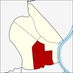
 Location in Bangkok Noi District | |
| Country | |
| Province | Bangkok |
| Khet | Bangkok Noi |
| Area | |
• Total | 2.076 km2 (0.802 sq mi) |
| Population (2020) | |
• Total | 29,122 |
| Time zone | UTC+7 (ICT) |
| Postal code | 10700 |
| TIS 1099 | 102005 |
Ban Chang Lo (Thai: บ้านช่างหล่อ, pronounced [bâːn t͡ɕʰâ(ː)ŋ lɔ̀ː]) is one of five subdistricts (khwaeng) and namesake historic neighbourhood in Bangkok Noi District, Bangkok's Thonburi side (west bank of Chao Phraya River).
- ^ Administrative Strategy Division, Strategy and Evaluation Department, Bangkok Metropolitan Administration (2021). สถิติกรุงเทพมหานครประจำปี 2563 [Bangkok Statistics 2020] (PDF) (in Thai). Retrieved 27 November 2021.
{{cite web}}: CS1 maint: multiple names: authors list (link)
Previous Page Next Page


