Our website is made possible by displaying online advertisements to our visitors.
Please consider supporting us by disabling your ad blocker.
Booie, Queensland
| Booie Kingaroy, Queensland | |||||||||||||||
|---|---|---|---|---|---|---|---|---|---|---|---|---|---|---|---|
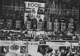
 Booie and Malar districts exhibition at Kingaroy Show, 1936 | |||||||||||||||
| Coordinates | 26°32′00″S 151°56′00″E / 26.5333°S 151.9333°E | ||||||||||||||
| Population | 1,094 (2021 census)[1] | ||||||||||||||
| • Density | 7.753/km2 (20.081/sq mi) | ||||||||||||||
| Established | 1877 | ||||||||||||||
| Postcode(s) | 4610 | ||||||||||||||
| Area | 141.1 km2 (54.5 sq mi) | ||||||||||||||
| Time zone | AEST (UTC+10:00) | ||||||||||||||
| Location | |||||||||||||||
| LGA(s) | South Burnett Region | ||||||||||||||
| State electorate(s) | Nanango | ||||||||||||||
| Federal division(s) | Maranoa | ||||||||||||||
| |||||||||||||||
Booie is a rural locality in the South Burnett Region, Queensland, Australia.[2] In the 2021 census, Booie had a population of 1,094 people.[1]
- ^ a b Cite error: The named reference
Census2021was invoked but never defined (see the help page). - ^ "Booie – locality in South Burnett Region (entry 49438)". Queensland Place Names. Queensland Government. Retrieved 29 December 2020.
Previous Page Next Page


