Our website is made possible by displaying online advertisements to our visitors.
Please consider supporting us by disabling your ad blocker.
Borough of Maidstone
Borough of Maidstone | |
|---|---|
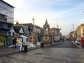
 Jubilee Square, Maidstone | |
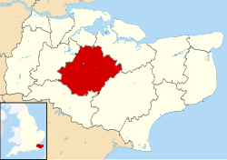
 Maidstone shown within Kent | |
| Coordinates: 51°16′24″N 0°31′20″E / 51.27333°N 0.52222°E | |
| Sovereign state | United Kingdom |
| Constituent country | England |
| Region | South East England |
| Non-metropolitan county | Kent |
| Status | Non-metropolitan district |
| Admin HQ | Maidstone |
| Incorporated | 1 April 1974 |
| Government | |
| • Type | Non-metropolitan district council |
| • Body | Maidstone Borough Council |
| • Leadership | Committees[1] (No overall control) |
| • MPs | Helen Whately Helen Grant |
| Area | |
• Total | 151.9 sq mi (393.3 km2) |
| • Rank | 87th (of 296) |
| Population (2022) | |
• Total | 180,428 |
| • Rank | 117th (of 296) |
| • Density | 1,200/sq mi (460/km2) |
| Ethnicity (2021) | |
| • Ethnic groups | |
| Religion (2021) | |
| • Religion | List
|
| Time zone | UTC0 (GMT) |
| • Summer (DST) | UTC+1 (BST) |
| ONS code | 29UH (ONS) E07000110 (GSS) |
| OS grid reference | TQ7588156056 |
The Borough of Maidstone is a local government district with borough status in Kent, England. Its administrative centre is Maidstone, the county town of Kent.
The borough was formed on 1 April 1974 by the merger of the municipal borough of Maidstone with the rural districts of Maidstone and Hollingbourne, under the Local Government Act 1972.[3]
- ^ "Agenda and minutes. Council Wednesday 10th December, 2014". Maidstone Borough Council. 10 December 2014. Item 102. Archived from the original on 15 February 2017. Retrieved 15 February 2017.
- ^ a b UK Census (2021). "2021 Census Area Profile – Maidstone Local Authority (E07000110)". Nomis. Office for National Statistics. Retrieved 5 January 2024.
- ^ The County of Kent (Electoral Changes) Order 2004 Archived 10 November 2004 at the Wayback Machine
Previous Page Next Page


