Our website is made possible by displaying online advertisements to our visitors.
Please consider supporting us by disabling your ad blocker.
Kane County, Utah
Kane County | |
|---|---|
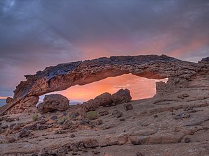
![Narrows in Diana's Throne Canyon, also known as the Huntress Slot in vicinity of Mount Carmel Junction.[1]](http://upload.wikimedia.org/wikipedia/commons/thumb/6/63/Narrows_in_Dianas_Throne_Canyon_-_DyeClan.com_-_panoramio_%282%29.jpg/220px-Narrows_in_Dianas_Throne_Canyon_-_DyeClan.com_-_panoramio_%282%29.jpg) Narrows in Diana's Throne Canyon, also known as the Huntress Slot in vicinity of Mount Carmel Junction.[1] | |
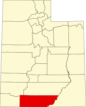
 Location within the U.S. state of Utah | |
 Utah's location within the U.S. | |
| Coordinates: 37°17′N 111°53′W / 37.29°N 111.89°W | |
| Country | |
| State | |
| Founded | January 16, 1864 |
| Named for | Thomas L. Kane |
| Seat | Kanab |
| Largest city | Kanab |
| Area | |
• Total | 4,109 sq mi (10,640 km2) |
| • Land | 3,990 sq mi (10,300 km2) |
| • Water | 118 sq mi (310 km2) 2.9% |
| Population (2020) | |
• Total | 7,667 |
| • Density | 1.9/sq mi (0.72/km2) |
| Time zone | UTC−7 (Mountain) |
| • Summer (DST) | UTC−6 (MDT) |
| Congressional district | 2nd |
| Website | kane |

Kane County is a county in the U.S. state of Utah. As of the 2020 United States Census, the population was 7,667.[2] Its county seat and largest city is Kanab.[3]
- ^ Diana's Throne
- ^ "Kane County, Utah". United States Census Bureau. Retrieved June 30, 2023.
- ^ "Find a County". National Association of Counties. Archived from the original on May 31, 2011. Retrieved June 7, 2011.
Previous Page Next Page


