Our website is made possible by displaying online advertisements to our visitors.
Please consider supporting us by disabling your ad blocker.
Karwar
This article needs additional citations for verification. (November 2022) |
Karwar
Kādwād Carwar, Koney [1] | |
|---|---|
Municipality /Taluk | |
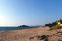
Clockwise from the Top: Tagore Beach, Arabian Sea from Sadashivgad fort, Majali Beach, Bridge over Kali River | |
 Karwar in Karnataka | |
| Coordinates: 14°48′N 74°08′E / 14.80°N 74.13°E | |
| Country | |
| State | Karnataka |
| District | Uttara Kannada |
| Government | |
| • Type | City Municipal Council |
| Area | |
| • Urban | 36.95 km2 (14.27 sq mi) |
| • Taluk | 743.4 km2 (287.0 sq mi) |
| Elevation | 6 m (20 ft) |
| Population (2011)[3] | |
| • CMC+Outgrowth | 77,139 |
| • Taluk | 155,213 |
| Demonym | Karwarkar |
| Time zone | UTC+5:30 (IST) |
| PIN | 581301 |
| Telephone code | 91-8382 |
| Vehicle registration | KA 30 |
| Official language | Kannada[4] |
| HDI (2014) | |
| Literacy (2014) | 89.91[5] |
| Sex ratio (2014) | 989 ♀/1000 ♂[5] |
| Website | karwarcity |
Karwar is a coastal town and the administrative headquarters of Uttara Kannada district, formerly part of the Bombay Presidency, located at the mouth of the Kali river along the Konkan Coast in the present-day state of Karnataka, India.
- ^ Madhav Anant Desai (1969). Chittakula-Karwar: A History. Google Books.
- ^ "Karwar city population". www.citypopulation.de/en.
- ^ "Sub-District Details". Office of the Registrar General & Census Commissioner, India. Retrieved 27 March 2012.
- ^ "50th Report of the Commissioner for Linguistic Minorities in India (July 2012 to June 2013)" (PDF). Archived from the original (PDF) on 8 July 2016. Retrieved 14 January 2015.
- ^ a b c Zilla Panchayat Uttara Kannada District Overview 2014 http://www.zpkarwar.kar.nic.in/docs/publication/English/EnglishPart2.pdf
Previous Page Next Page


