Our website is made possible by displaying online advertisements to our visitors.
Please consider supporting us by disabling your ad blocker.
Manley Hot Springs, Alaska
This article has multiple issues. Please help improve it or discuss these issues on the talk page. (Learn how and when to remove these messages)
|
Manley Hot Springs
Too Naaleł Denh | |
|---|---|
 Manley Hot Springs welcome sign | |
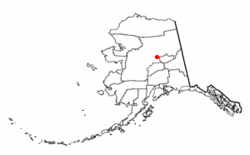
 Location of Manley Hot Springs, Alaska | |
| Coordinates: 65°0′28″N 150°37′36″W / 65.00778°N 150.62667°W | |
| Country | United States |
| State | Alaska |
| Census Area | Yukon-Koyukuk |
| Government | |
| • State senator | Click Bishop (R) |
| • State rep. | Mike Cronk (R) |
| Area | |
• Total | 54.61 sq mi (141.44 km2) |
| • Land | 54.61 sq mi (141.44 km2) |
| • Water | 0.00 sq mi (0.00 km2) |
| Population (2020) | |
• Total | 169 |
| • Density | 3.09/sq mi (1.19/km2) |
| Time zone | UTC-9 (Alaska (AKST)) |
| • Summer (DST) | UTC-8 (AKDT) |
| ZIP code | 99756 |
| Area code | 907 |
| FIPS code | 02-46780 |
Manley Hot Springs (Too Naaleł Denh in Koyukon) is a census-designated place (CDP) in Yukon-Koyukuk Census Area, Alaska, United States. At the 2020 census the population was 169, up from 89 in 2010.[2]
- ^ "2020 U.S. Gazetteer Files". United States Census Bureau. Retrieved October 29, 2021.
- ^ "2020 Census Data - Cities and Census Designated Places" (Web). State of Alaska, Department of Labor and Workforce Development. Retrieved October 31, 2021.
Previous Page Next Page


