Our website is made possible by displaying online advertisements to our visitors.
Please consider supporting us by disabling your ad blocker.
Parsa National Park
| Parsa National Park | |
|---|---|
 Indian pitta at Parsa National Park | |
| Location | Nepal |
| Nearest city | Birgunj |
| Coordinates | 27°28′N 84°20′E / 27.467°N 84.333°E |
| Area | 627.39 km2 (242.24 sq mi) |
| Established | 1984 as Wildlife Reserve, 2017 as National Park |
| Governing body | Department of National Parks and Wildlife Conservation |
 | |
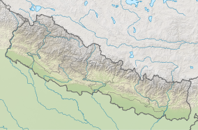
Parsa National Park is a national park in the Terai of south-central Nepal covering an area of 627.39 km2 (242.24 sq mi) in the Parsa, Makwanpur and Bara Districts and ranging in elevation from 435 to 950 m (1,427 to 3,117 ft) in the Sivalik Hills. It was established as a wildlife reserve in 1984 and received national park status in 2017. It is surrounded by a buffer zone since 2005 with an area of 285.3 km2 (110.2 sq mi).[1] In 2015, the protected area was further extended by 49 sq mi (128 km2).[2]
To the north of Parsa National Park, the East Rapti River and Sivalik Hills form a natural boundary to human settlements. To the east, the boundary extends up to the Hetauda–Birgunj highway; to the south, a forest road demarcates the park's boundary. To the west is Chitwan National Park, which is situated just north of Valmiki National Park, a tiger reserve in India. Thus, this transnational protected area of 2,075 km2 (801 sq mi) represents the Tiger Conservation Unit (TCU) Chitwan–Parsa–Valmiki, which covers a total of 3,549 km2 (1,370 sq mi) in the Terai–Duar savanna and grasslands.[3]
Before being converted to a protected area, the region was a private game reserve and hunting park for both the British and Nepalese elite.[1][4]
- ^ a b Bhuju, U. R.; Shakya, P. R.; Basnet, T. B.; Shrestha, S. (2007). Nepal Biodiversity Resource Book. Protected Areas, Ramsar Sites, and World Heritage Sites (PDF). Kathmandu: International Centre for Integrated Mountain Development, Ministry of Environment, Science and Technology, in cooperation with United Nations Environment Programme, Regional Office for Asia and the Pacific. ISBN 978-92-9115-033-5. Archived from the original (PDF) on 2011-07-26. Retrieved 2018-12-14.
- ^ Anonymous. 2015. Good news for tigers as Nepal extends Parsa Wildlife Archived 2018-07-09 at the Wayback Machine. Wildlife Extra, 9 September 2015.
- ^ Wikramanayake, E.D., Dinerstein, E., Robinson, J.G., Karanth, K.U., Rabinowitz, A., Olson, D., Mathew, T., Hedao, P., Connor, M., Hemley, G., Bolze, D. (1999). Where can tigers live in the future? A framework for identifying high-priority areas for the conservation of tigers in the wild. Archived 2012-03-10 at the Wayback Machine In: Seidensticker, J., Christie, S., Jackson, P. (eds.) Riding the Tiger. Tiger Conservation in human-dominated landscapes. Cambridge University Press, Cambridge. hardback ISBN 0-521-64057-1, paperback ISBN 0-521-64835-1. Pages 255–272 "Archived copy". Archived from the original on April 6, 2012. Retrieved 2012-03-10.
{{cite web}}: CS1 maint: archived copy as title (link) - ^ Majupuria, T.C., Kumar, R. (1998) Wildlife, National Parks and Reserves of Nepal. S. Devi, Saharanpur and Tecpress Books, Bangkok. ISBN 974-89833-5-8. Pages 245–248.
Previous Page Next Page


