Our website is made possible by displaying online advertisements to our visitors.
Please consider supporting us by disabling your ad blocker.
Prairie Township, Warren County, Indiana
Prairie Township | |
|---|---|
 Location of Prairie Township in Warren County | |
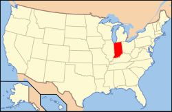
 Location of Indiana in the United States | |
| Coordinates: 40°26′28″N 87°27′23″W / 40.44111°N 87.45639°W | |
| Country | United States |
| State | Indiana |
| County | Warren |
| Established | 1864 |
| Government | |
| • Type | Indiana township |
| Area | |
• Total | 47.66 sq mi (123.4 km2) |
| • Land | 47.66 sq mi (123.4 km2) |
| • Water | 0 sq mi (0 km2) 0% |
| Elevation | 728 ft (222 m) |
| Population (2020) | |
• Total | 230 |
| • Density | 4.8/sq mi (1.9/km2) |
| Time zone | UTC-5 (Eastern (EST)) |
| • Summer (DST) | UTC-4 (EDT) |
| Area code | 765 |
| GNIS feature ID | 453772 |
Prairie Township is one of twelve townships in Warren County, Indiana, United States. According to the 2020 census, its population was 230 and it contained 110 housing units;[2] the population density is the lowest of any township in the county, at 6.1 inhabitants per square mile (2.4/km2).[3]
| Census | Pop. | Note | %± |
|---|---|---|---|
| 1890 | 763 | — | |
| 1900 | 826 | 8.3% | |
| 1910 | 792 | −4.1% | |
| 1920 | 801 | 1.1% | |
| 1930 | 838 | 4.6% | |
| 1940 | 742 | −11.5% | |
| 1950 | 667 | −10.1% | |
| 1960 | 583 | −12.6% | |
| 1970 | 397 | −31.9% | |
| 1980 | 396 | −0.3% | |
| 1990 | 318 | −19.7% | |
| 2000 | 290 | −8.8% | |
| 2010 | 257 | −11.4% | |
| 2020 | 230 | −10.5% | |
| Source: US Decennial Census[4] | |||
- ^ "US Board on Geographic Names". United States Geological Survey. October 25, 2007. Retrieved May 9, 2017.
- ^ "Explore Census Data". data.census.gov. Retrieved April 14, 2024.
- ^ "Population, Housing Units, Area, and Density: 2010 - County – County Subdivision and Place – 2010 Census Summary File 1". United States Census. Archived from the original on February 12, 2020. Retrieved May 10, 2013.
- ^ "Township Census Counts: STATS Indiana".
Previous Page Next Page


