Our website is made possible by displaying online advertisements to our visitors.
Please consider supporting us by disabling your ad blocker.
Riverside Historic District (Riverside, Illinois)
Riverside Historic District | |
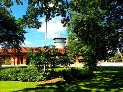
 The Riverside Water Tower from Guthrie Park | |
| Location | Riverside, Illinois |
|---|---|
| Coordinates | 41°49′54″N 87°48′49″W / 41.83167°N 87.81361°W |
| Area | 1,500 acres (610 ha) |
| Built | 1868 |
| Architect | Calvert Vaux; Frederick Law Olmsted; Frank Lloyd Wright |
| NRHP reference No. | 69000055 |
| Significant dates | |
| Added to NRHP | September 15, 1969[1] |
| Designated NHLD | August 29, 1970[2] |
The Riverside Historic District, also known as Riverside Landscape Architecture District, encompasses what is arguably one of the first planned suburbs in the United States. The district encompasses the majority of the village of Riverside, Illinois, a suburb just west of Chicago. It was planned and designed by Calvert Vaux and Frederick Law Olmsted and features a number of architecturally distinguished buildings.[3]
- ^ "National Register Information System". National Register of Historic Places. National Park Service. January 23, 2007.
- ^ "Riverside Historic District". National Historic Landmark summary listing. National Park Service. Retrieved October 11, 2007.
- ^ National Register Information System. Accessed 2010-19-03.
Previous Page Next Page


