Our website is made possible by displaying online advertisements to our visitors.
Please consider supporting us by disabling your ad blocker.
Sankuru
Sankuru
Province du Sankuru (French) | |
|---|---|
 | |
| Coordinates: 3°31′S 23°36′E / 3.517°S 23.600°E | |
| Country | |
| Created | 2015 |
| Named for | Sankuru River |
| Capital | Lusambo |
| Government | |
| • Governor | Victor Kitenge[1] |
| Area | |
• Total | 105,000 km2 (41,000 sq mi) |
| Population (2020 est.) | |
• Total | 2,593,400 |
| • Density | 25/km2 (64/sq mi) |
| Time zone | UTC+2 (CAT) |
| License Plate Code | |
| Official language | French |
| National language | Tshiluba |
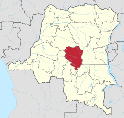
Sankuru is one of the 21 provinces of the Democratic Republic of the Congo created in the 2015 repartitioning. Sankuru, Kasaï-Oriental, and Lomami provinces are the result of the dismemberment of the former Kasaï-Oriental province.[2] Sankuru was formed from the Sankuru District whose town of Lusambo was elevated to capital city of the new province.
The 2020 population was estimated to be 2,593,400.[3]
- ^ "LE NOUVEAU GOUVERNEUR KITENGE PREND SES QUARTIERS A LUSAMBO (Sankuru) : Lutundula, Mende, Mpetshi et Ekoto mettent le cap sur le développement". Le Maximum (in French). 29 August 2024. Retrieved 2 September 2024.
- ^ "RDC : le Kasaï-Oriental éclate en trois nouvelles provinces". Radio Okapi (in French). 16 July 2015. Archived from the original on 18 July 2015. Retrieved 3 June 2020.
- ^ "Congo (Dem. Rep.): Provinces, Major Cities & Towns - Population Statistics, Maps, Charts, Weather and Web Information". www.citypopulation.de. Retrieved 2024-02-11.
Previous Page Next Page


