Our website is made possible by displaying online advertisements to our visitors.
Please consider supporting us by disabling your ad blocker.
Streatley, Berkshire
| Streatley | |
|---|---|
| Village and civil parish | |
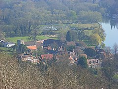
 Streatley nucleus and riverside beyond. | |
Location within Berkshire | |
| Area | 13.14 km2 (5.07 sq mi) |
| Population | 1,060 (2011 census)[1] |
| • Density | 81/km2 (210/sq mi) |
| OS grid reference | SU5980 |
| Civil parish |
|
| Unitary authority | |
| Ceremonial county | |
| Region | |
| Country | England |
| Sovereign state | United Kingdom |
| Post town | Reading |
| Postcode district | RG8 |
| Dialling code | 01491 |
| Police | Thames Valley |
| Fire | Royal Berkshire |
| Ambulance | South Central |
| UK Parliament | |
| Website | Streatley Parish Council |
Streatley is a village and civil parish on the River Thames in Berkshire, England. The village faces Goring-on-Thames. The two places share in their shops, services, leisure, sports and much of their transport. Across the river is Goring & Streatley railway station and the village cluster adjoins a lock and weir. The west of the village is a mixture of agriculture and woodland plus a golf course. The village has a riverside hotel. Much of Streatley is at steeply varying elevations, ranging from 51 to 185 m (167 to 607 ft) above ordnance datum (AOD) at Streatley Warren, a hilltop point on its western border forming the eastern end of the Berkshire Downs. This Area of Outstanding Natural Beauty is topped by the 87 mi (140 km) The Ridgeway path, which crosses the Thames at Goring and Streatley Bridge.
Previous Page Next Page


