Our website is made possible by displaying online advertisements to our visitors.
Please consider supporting us by disabling your ad blocker.
Verman (river)
| Verman | |
|---|---|
 | |
 | |
| Location | |
| Country | Russia |
| Region | Murmansk Oblast |
| Physical characteristics | |
| Source | |
| • location | Southern slopes of Mount Repotunturi |
| • elevation | 250 m (820 ft) |
| Mouth | Lake Tolvand |
• coordinates | 66°55′06″N 31°12′35″E / 66.9183°N 31.2098°E |
• elevation | 97 m (318 ft) |
| Length | 38 km (24 mi) |
| Basin size | 291 km2 (112 sq mi) |
| Basin features | |
| Progression | Lake Tolvand→ Tolvand→ Lake Kovdozero→ Kovda→ White Sea |
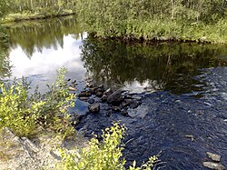
The Verman (Russian: Верман, Finnish: Vermanjoki) is a river in Murmansk Oblast, Russia. For much of the Arctic Campaign of World War II stretches of it formed the front line, and much fighting occurred there.
Previous Page Next Page


