Back اينيشتراهول ARZ Inis Trá Tholl BR Inishtrahull CEB Inishtrahull English Inishtrahull Spanish Inishtrahull EU Inishtrahull French Inis Trá Tholl GA Inishtrahull Italian イニッシュトラウール島 Japanese
| Inistrahull Island
| ||
|---|---|---|
 | ||
| Gewässer | Schottische See | |
| Geographische Lage | 55° 26′ 0″ N, 7° 14′ 0″ W | |
|
| ||
| Länge | 1,3 km | |
| Breite | 480 m | |
| Fläche | 34 ha | |
| Höchste Erhebung | 41 m | |
| Einwohner | unbewohnt | |
 | ||
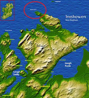
Inishtrahull Island (irisch: Inis Trá Tholl – „Insel des leeren Strands“) liegt rund 10 km nördlich von Malin Head, Inishowen im irischen County Donegal.
