Back Atolón de Lae AST Atol Lae Catalan Lae (pulo) CEB Lae Atoll English Lae (atolón) Spanish آبسنگ حلقوی لائه FA Lae (atolli) Finnish Lae (atoll) French Atol Lae GL Lae Croatian
| Lae | ||
|---|---|---|
 | ||
| Gewässer | Pazifischer Ozean | |
| Archipel | Marshallinseln | |
| Geographische Lage | 8° 56′ N, 166° 14′ O | |
|
| ||
| Anzahl der Inseln | 17 | |
| Hauptinsel | Lae | |
| Landfläche | 1,45 km² | |
| Lagunenfläche | 17,66 km² | |
| Einwohner | 133 (2021) | |
 | ||
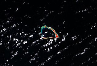
Lae (deutsch veraltet: Browninseln[1]) ist ein Atoll der Ralik-Kette der Marshallinseln. Das Atoll hat eine Landfläche von 1,45 km², die eine Lagune von 17,66 km² umschließt. Die Lagune des Atolls hat nur einen schiffbaren Zugang zum Meer. Auf dem Atoll leben 133 Einwohner (Stand 2021).[2]
- ↑ Deutsches Koloniallexikon. Hrsg. von Heinrich Schnee. - Leipzig: Quelle & Meyer 1920. - 3 Bde.
- ↑ Republic of the Marshall Islands 2021 Census Report. Band 1: Basic Tables and Administrative Report. Secretariat of the Pacific Community, 2023, Table 3: Population by Urban/Rural and atoll by sex, S. 10 (englisch, Downloadlink auf sdd.spc.int [PDF; 3,9 MB; abgerufen am 16. Juni 2024]).
