Back Halga Uincentius seo ieg ANG سانت فينسنت Arabic Sent-Vinsent adası AZ Сент-Вінсент BE Enez Sant Visant BR Saint Vincent (illa) Catalan Saint Vincent (pulo sa Saint Vincent ug ang Grenadines) CEB Svatý Vincenc (ostrov) Czech Saint Vincent Danish Άγιος Βικέντιος Greek
| St. Vincent
| |
|---|---|
 | |
| Gewässer | Karibisches Meer |
| Inselgruppe | Inseln über dem Winde |
| Geographische Lage | 13° 15′ N, 61° 12′ W |
 | |
| Fläche | 347 km² |
| Höchste Erhebung | Soufrière 1220 m |
| Einwohner | 99.757 (2012[1]) 287 Einw./km² |
| Hauptort | Kingstown |
 | |
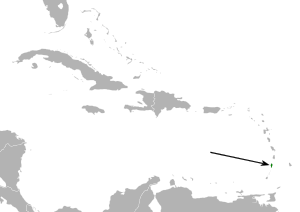
St. Vincent (englisch Saint Vincent) ist eine Insel in der Karibik. St. Vincent war auch der Name der britischen Kolonie, deren Hauptinsel die Insel St. Vincent war und die unter dem geänderten Namen St. Vincent und die Grenadinen 1969 unabhängig wurde.
- ↑ St. Vincent and the Grenadines Population and Housing Census Report 2012. Government of Saint Vincent and the Grenadines – Statistical Office, Central Planning Division, Ministry of Finance, Planning and Economic Development, 2012, Table 1.3: Population Density by Census Division, 2001 & 2012, S. 18 (englisch, stats.gov.vc [PDF; 8,0 MB; abgerufen am 31. Oktober 2024]).